With a changing climate, the hydrological aspect of turf maintanace is becomming more and more important. Therefore, Lumbricus has developed a systematic aproach that enables us to design the best drainage systems possible that discard of water when there is an acces, but hold enough water for the plants to maintain optimal growth.
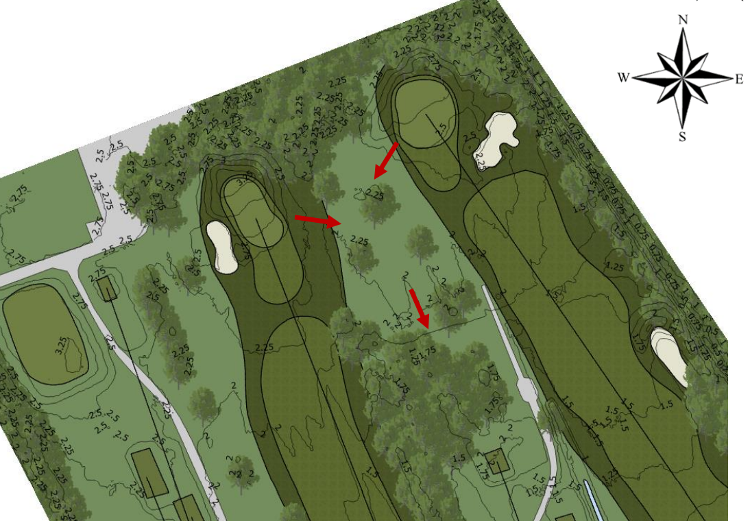
First, the elevation of the respective course or field is visualised within a Geo Information System (GIS).

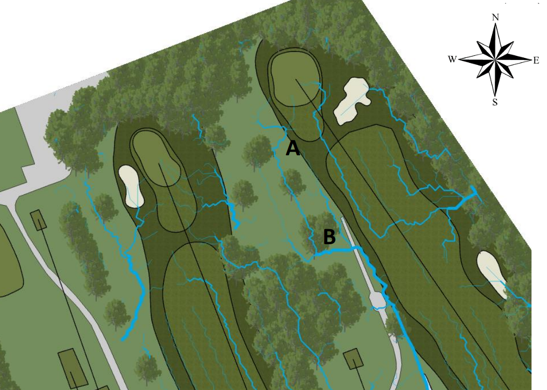
Next, advance hydrological models are used to calculate the water flow lines using the elevation data as input. The order of the flow lines is visualised using thinker lines i.e. when two streams connect, this results in one thicker line.

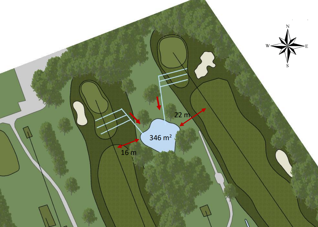
Based on these maps, we design the optimal location for drains and basins to store water. The design takes the game itselfs into account by choosing the location that has the least negative effects on the game. Furthermore, the location choosen in a way that the water takes the natural routes that optimise the drain capabilities. The figure below presents the final design based on the previous steps. Calculation for the optimal distance of the drain are explained in this article and more explanation for ecological design of basins and ponds are given here.

