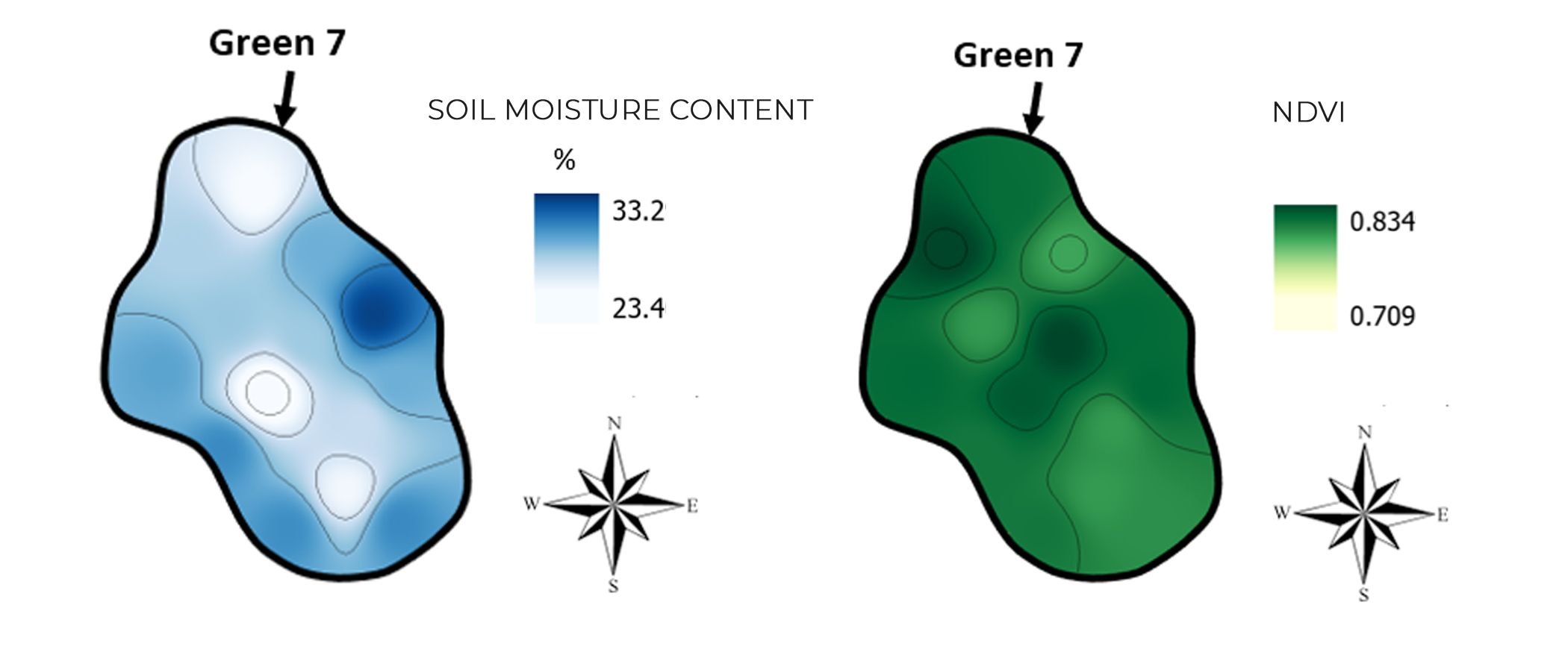
Whenever we are working within our natural environment – that is to say, whenever we are working with soil, plants, water and so on – we rarely see any homogeneity. In other words, our environment is very divers. For example, if we want measure moisture content, the measured values can be different every time we perform a measurement. Therefor, Lumbricus developed the Golf Quality Monitoring.
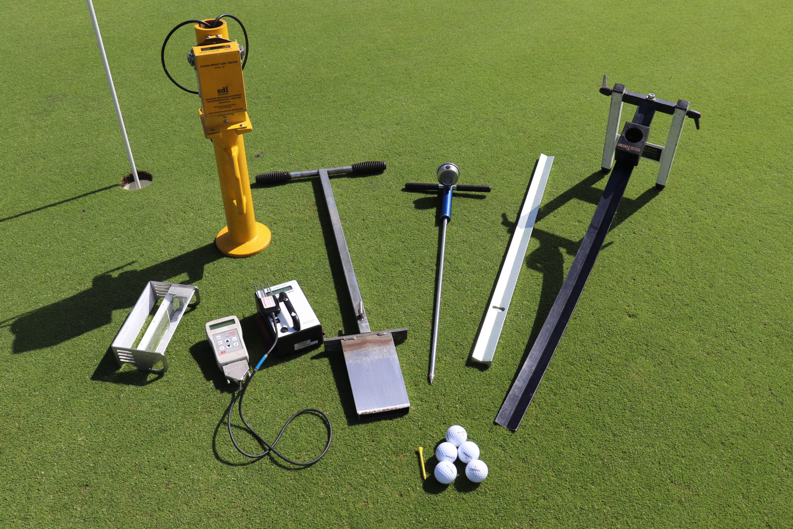
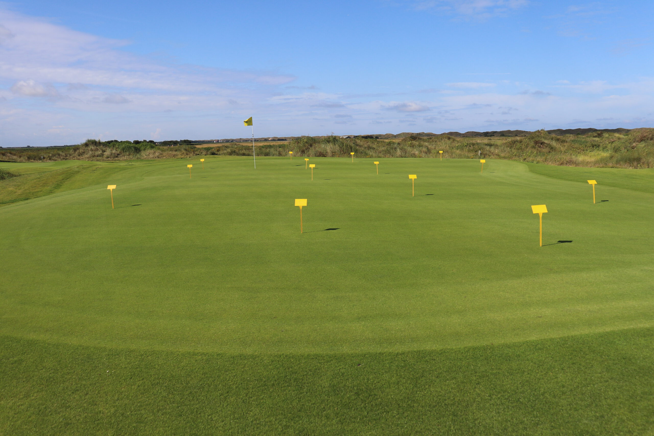
By taking multiple measurements per green using GPS locations, all of the heterogeneity can be visualized when the data is analysed using advanced GIS interpolations. Per green approximately 14 measurements – depending on the size of the green – are taken. These measurements include:
- Soil Moisture
- NDVI
- Firmness (Clegg)
- Thatch Thickness
- and Grass Cover
The collected data is interpolated and 2D maps are used to analyse the heterogeneity of the greens. Examples of these maps are shown below. With these maps, the greenkeepers can focus on specific areas where problems might occur. By this precision management, not only the quality increases, but it also decreases the risks of problems like disease.
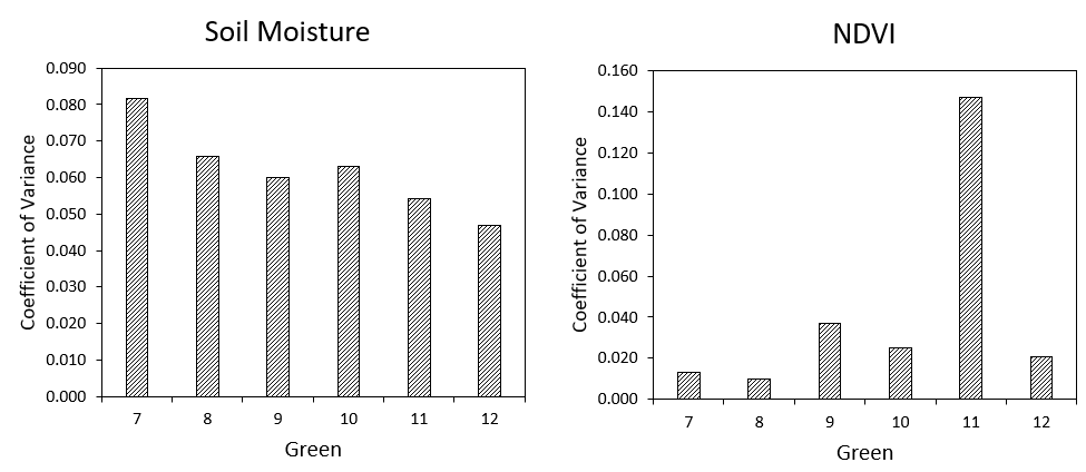
Because there is spatial data available, statistics can be used to quantify the variation within a green. This quantified measure is called the “coefficient of variance”. The higher this value, the more variation within a green. The goal for the greenkeepers would be to get this number as small as possible. To this end, Lumbricus will provide a report with strategies to help optimize your Golf course.